
Is your land suitable for a wind turbine?
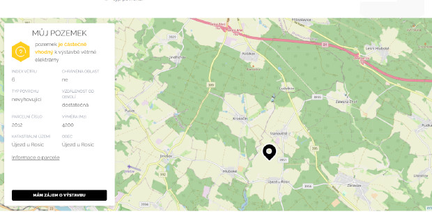
Wind farm site map
A map application for JRD Energo that showed landowners within moments whether their plot was suitable for building a wind turbine.
Challenge: JRD Energo was looking for land for wind farms and wanted landowners to be able to check their plot's suitability themselves - without GIS skills or studying maps.
Solution: We built a simple map application for the foukami.cz website. For a selected plot it showed basic land register data with a link, the average wind speed 100 m above ground, protected landscape areas, bird areas and national parks, the distance from homes and other infrastructure, and the landscape type. From these the app assessed whether the plot was suitable, partly suitable or unsuitable.
Result: Landowners got an answer in a few clicks and could register their interest straight away, so JRD Energo received enquiries directly from owners of suitable land.